
Cartographic examples
Clarke Geospatial delivers clear, intuitive mapping and data visualisation — no matter your industry or how complex your information, we make it simple.
Formula 1 circuits
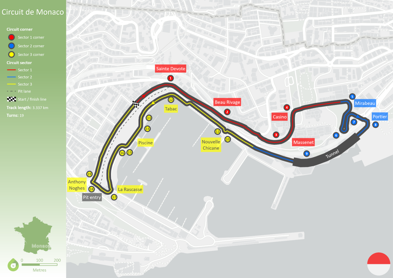
The Monaco Grand Prix, first held in 1929, is one of the most prestigious and iconic races in Formula One, renowned for its challenging street circuit and rich history of legendary drivers.
The track may have evolved over the years, but the tight twisting corners largely remains the same.
Security incidents
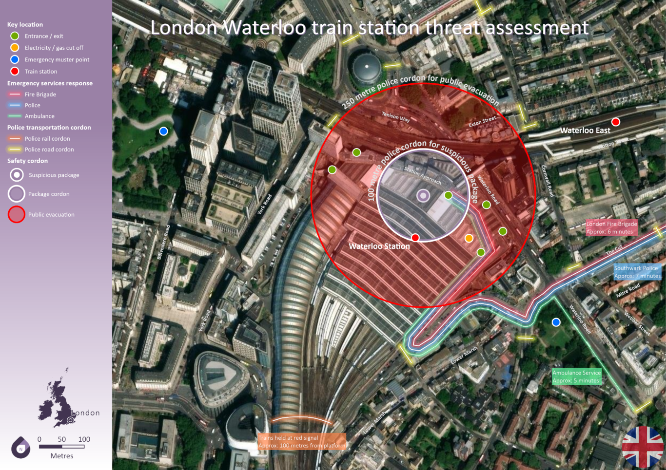
Emergency services routinely prepare for worst case scenarios occuring in major transportation hubs.
Here we can see Waterloo station, complete with entrance / exit detail, emergency services routes from nearby stations and safety cordons.
The example illustrating the areas impacted by a suspicious item.
Gold mining activity
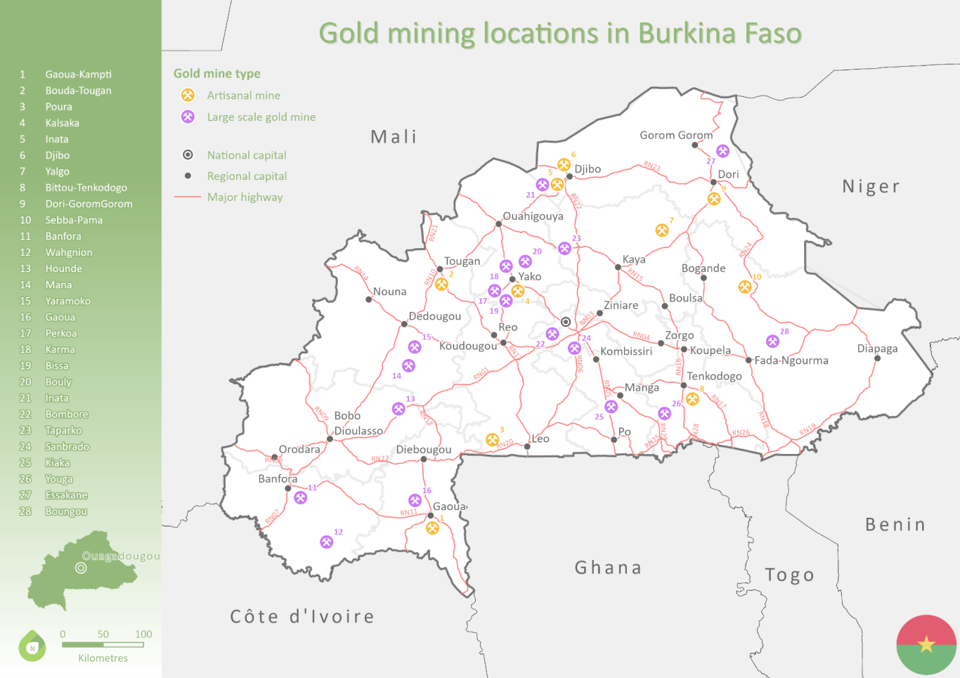
Across Burkina Faso, there are a variety of Gold mining operations active. Some of which are smaller artisan facilites, whichlst the majority are larger scale mines, used by larger commodity based organisations.
The data in this example utilises open source data, which is freely available online.
Tourist key locations
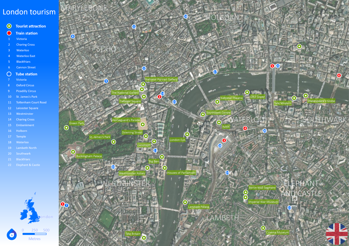
Whilst routinely found in most major cities, tourist maps are often used to show major transportation links and key tourist attractions.
City plans like this however, are not limited to tourism, but can often give a useful overiew of key locations of interest, including government, diplomatic and miltary use within the cities.
They can also be used to highlight key transportation links and bottles necks during peak times.
Pattern of life
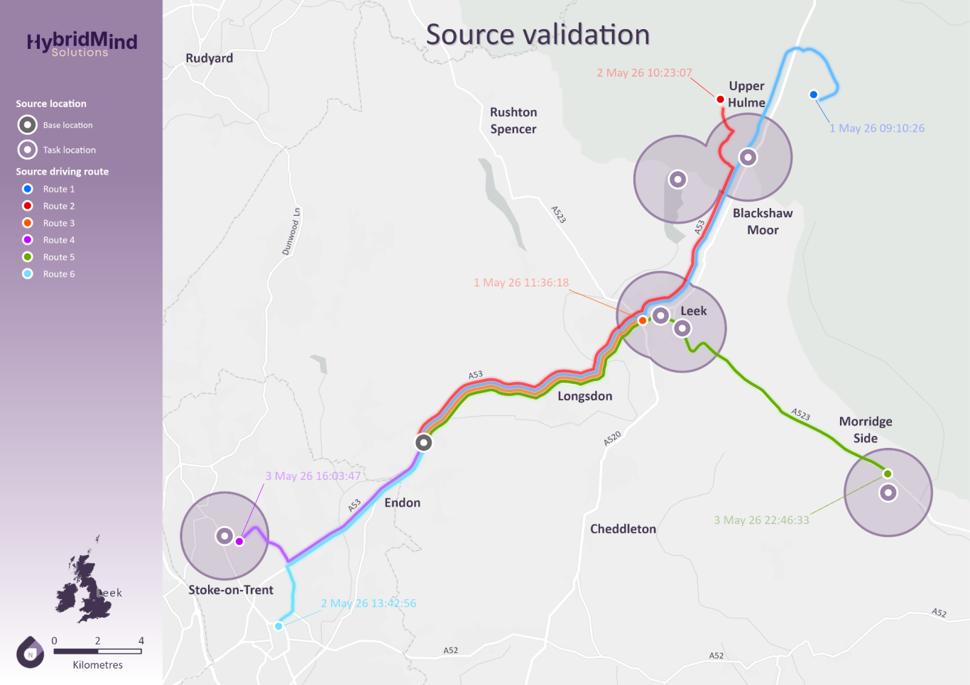
In the world of intelligence, it is often key to display the activity of an organisation or individual of interest. This is often referred to as pattern of life.
This can include locations frequented under monitoring, or when a source has key locations to liaise with third parties.
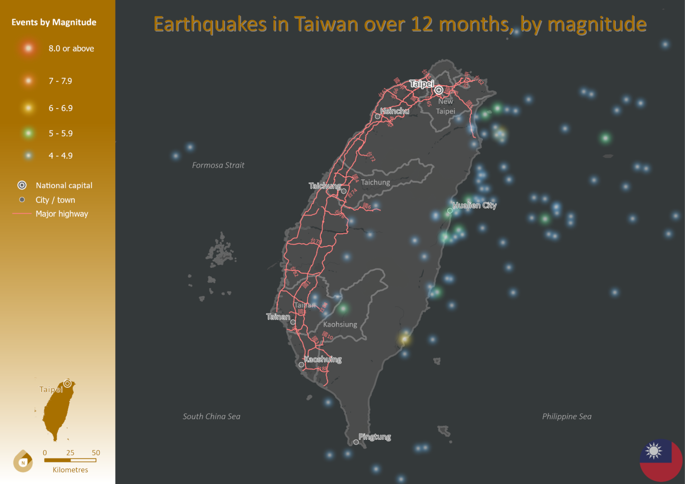
Earthquakes by magnitude
Using live datasets it is possible to monitor environmental impacts on larger scales.